Owner
Network Rail
Client
Network Rail
Cost
unknown
Timeframe
November 2021
— March 2022
Services performed
Tunnel condition survey, detailed examination, geological field mapping, stereonet projection, unlined tunnel geotechnical risk assessment, Wedge stability analysis, Form 7 design, Matterport 3D model and reality capture, 3D laser scanning.
Description
Flax Bourton tunnel is 102m long on a straight alignment running approximately East-West immediately north of the village of Flax Bourton near Bristol. There is a brickwork lined section at each end of the tunnel bore; 9m long at low mileage, 11m at high mileage. Between these two lined sections, the tunnel is comprised of 82m of unlined rock. A softer red marl layer has been faced with masonry in an approximately 900-1000mm deep band just below the springing point along both the upside and downsides of the unlined section. These unlined sections also have roughly vertical walls, with haunch and crown of variable shape.
Geology
The prevailing strata is the Hotwells Limestone Formation with the unlined tunnel section consisting of medium strong to strong limestone (source: British Geological Survey maps portal).
Location
Flax Bourton, Somerset, UK
Highlights
- Unlined Victorian Rock Railway Tunnel
- Wedge Stability Analysis
- Geological Field Mapping
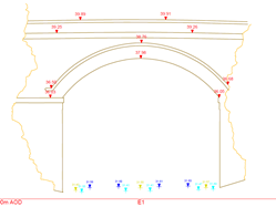
Typical cross section masonry lined portals
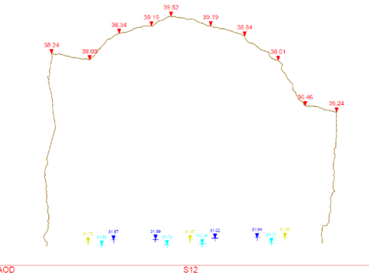
Typical cross section unlined rock
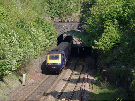
Tunnel portal
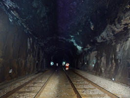
Photo of unlined section