Owner
Irish Rail
Client
Ground Investigation Ireland (GII)
Cost
€185 million (Cork Area Commuter Rail Programme, phase one)
Timeframe
July 2023
— August 2023
Services performed
Supply of a Ground Interpretative Report (GIR) for the 10km route including geology and geohydrology assessments, and rock slope mapping.
Description
Irish Rail (Iarnród Éireann) plans to enhance commuter services into and out of Cork city. The Glounthaune to Midleton Twin Track project covers a distance of approximately 10km, where the existing line will be upgraded to twin track. The project will help to triple service frequency. Redevelopment works include: renewal of existing railway track plus the addition of a secondary track; widening of existing earthworks in soil and rock (cuttings and embankments); construction of new retaining walls, including gravity, gabion and sheet piled walls; and extensions and alterations to existing underbridges and culverts.
Geology
Superficial deposits include Cohesive and Granular Alluvium, Cohesive Till, Glacial Sand and Gravel. Deposits are underlain by Limestone and Mudstone (Waulsortian & Ballysteen Formation).
Location
Cork, Ireland
Highlights
- Identification of route-wide Karst geo-hazards.
- Handling AGS data using Bentley OpenGround.
- Compliance with Irish design codes.
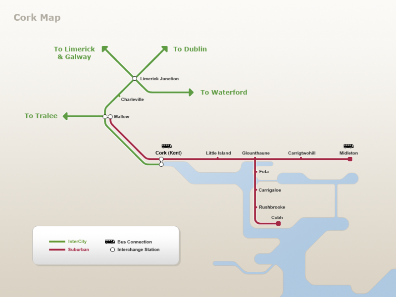
Glounthaune – Midleton Twin Track project overview (courtesy www.irishrail.ie).
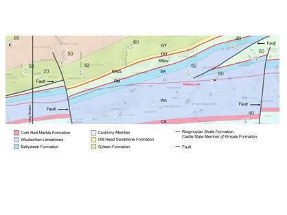
Glounthaune – Midleton Twin Track geological map.